


 https://canoeadventure.com.au/
Canoe Adventures Riverland hire and deliver kayaks in this area.
www.facebook.com/
 Paddle SA is the governing body of paddle sport and recreation in South Australia. It leads and supports paddling in South Australia and encourages the safe exploration of our waterways.
Paddling Trail South Australia has a range of Paddling Trails to suit different abilities.
Know your ability.
Paddle SA is the governing body of paddle sport and recreation in South Australia. It leads and supports paddling in South Australia and encourages the safe exploration of our waterways.
Paddling Trail South Australia has a range of Paddling Trails to suit different abilities.
Know your ability.  If you have a smartphone or tablet you can download the free Avenza PDF Map app and have interactive paddling trail maps on hand when you need them. The app uses your device’s built-in GPS to plot your real-time location within the park onto a map. The app can be used without a network connection and without roaming charges. You can also measure area and distance, plot photos, and drop Placemark pins.
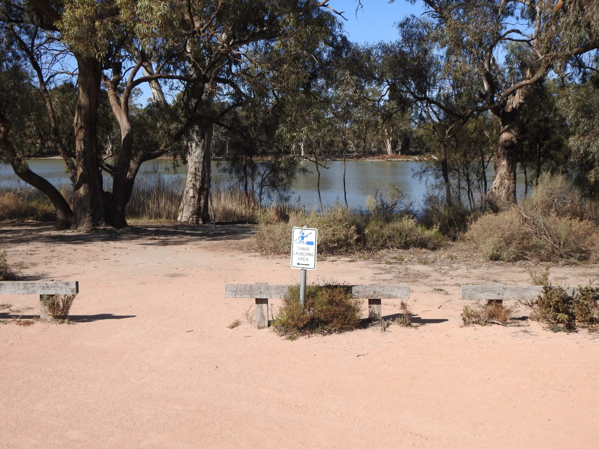
![]() Canoe Launch near Border Cliffs Customs House (GPS: 33.9727 S; 140.9575 E)
Canoe Launch near Border Cliffs Customs House (GPS: 33.9727 S; 140.9575 E)
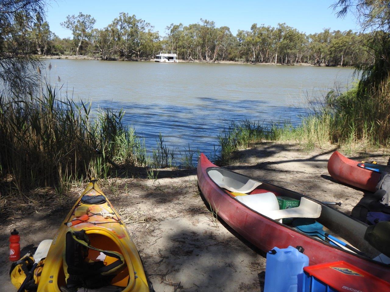
Start at Canoe launch near Border Cliffs Customs House (GPS: 33.9727 S; 140.9575 E).
Paddle downstream to Suders Creek, known as the “Shute” (approximately 150m). This is a fast-flowing, narrow creek (entered by leaving the main river on the right-hand side). The Shute connects the Murray River and Hypurna Creek. Once you enter The Shute, you will be swept right through it. Consider reconnoitring it from land to check for current obstacles.
NOTE: If the “Shute” is considered too hazardous for the skills of the group the alternative is to paddle upstream for approximately 1.5 kms to a portage point just before the 638 Km marker (Point W: GPS: 33.9828 S; 140.9686 E). Portage into Hypurna Creek (approximately 75 m) and then paddle back down to the junction of the “Shute”. This alternative route has an approximate distance of 2.2 kms in addition to the 75m portage.
When you reach Hypurna Creek from the “shute” turn left and continue to the junction with Salt Creek (approximately 200m) at Point H (GPS:33.9711 S; 140.9683 E). The stumps of an old footbridge may be visible in the water near this junction.
Turn right into Salt Creek and continue to paddle along this waterway. You will notice that there are two branches of Punkah Creek that appear on the LHS at approximately 4 kms and then again 750m later at Point J (GPS 33.9636 S; 141. 0016 E). Do not take these, but remain on Salt Creek.
You have now crossed the border into NSW and will continue to crisscross the border a number of times throughout this trip. NOTE: In NSW you are in Kulkurna (formerly Tareena Station) and camping is not permitted.
After a further 4.3kms Salt Creek divides into 2 branches at Point L (GPS 33.9797 S 141.0032). At this point you are on the border between SA and NSW.
Note: the LH branch is approximately 1.8km long and is the deeper waterway but may have some snags to negotiate. The RH branch is approximately 4.2kms in length and travels along a shallower horseshoe lake which in low river flow years may be dry. However large flocks of up to 150 birds of black swans or Australian pelicans may be seen in the horseshoe lake when there is water about.
The LH and RH branches meet at Point M (GPS: 33.9803 S 141.0164 E). Turn left here (or continue straight along if you have taken the RH branch) to follow Salt Creek. Paddle for a further 7.8km.
Look for a creek entrance to your right at Point S (GPS: 34.0188 S; 141.0469 E) noting that this is still Salt Creek here; turn right and continue for approximately 3.2km to the junction with Hypurna Creek on the RHS Point Q (GPS:34.0215 S; 141.0250 E). Note this section could have fallen trees to negotiate.
Turn right into Hypurna Creek and continue to paddle for approximately 5.6km to the next significant junction at Point N (GPS: 33.9943 S; 140.9950 E).
Note: you are now back in South Australia!
Take the right hand branch and continue for about 4 km where there will be a sharp bend to the right at this point. Soon after this bend there is a rusted tin marker identifying the portage point (Point W: GPS: 33.9828 S; 140.9686 E) which will return you back to the Murray River.
Turn right in the river and you will soon be back to your initial launch point at the Border Cliffs Canoe Launch site.
![]()
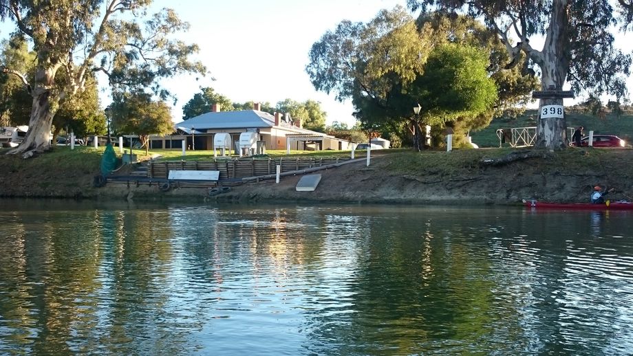
Shady trees, café, toilets. Grassy area, picnic tables, and BBQ belong to Customs House so ask before using them.