


 Paddle SA is the governing body of paddle sport and recreation in South Australia. It leads and supports paddling in South Australia and encourages the safe exploration of our waterways.
Paddling Trail South Australia has a range of Paddling Trails to suit different abilities.
Know your ability.
Paddle SA is the governing body of paddle sport and recreation in South Australia. It leads and supports paddling in South Australia and encourages the safe exploration of our waterways.
Paddling Trail South Australia has a range of Paddling Trails to suit different abilities.
Know your ability.  https://canoeadventure.com.au/
Canoe Adventures Riverland hire and deliver kayaks in this area.
www.facebook.com/
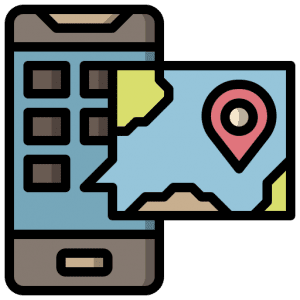
 If you have a smartphone or tablet you can download the free Avenza PDF Map app and have interactive paddling trail maps on hand when you need them. The app uses your device’s built-in GPS to plot your real-time location within the park onto a map. The app can be used without a network connection and without roaming charges. You can also measure area and distance, plot photos, and drop Placemark pins.
![]() Canoe Launch in Chowilla Game Reserve Border Cliffs campground GPS: 33.9727 S; 140.9575 E
Canoe Launch in Chowilla Game Reserve Border Cliffs campground GPS: 33.9727 S; 140.9575 E
Paddle downstream to Suders Creek and enter the “Shute” (approximately 150m long). This is a fast-flowing, narrow creek (entered by leaving the main river on the right-hand side). The Shute connects the Murray River and Hypurna Creek.
(NOTE: If the “Shute” is considered too hazardous for the skills of the group the alternative is to paddle upstream for approximately 1.5 kms to a portage point (watch for a small “portage” sign nailed to a tree) just before the 638 Km marker (Point W: GPS: 33.9828 S; 140.9686 E).
Portage into Hypurna Creek (approximately 75m) and then paddle back down to the junction of the “Shute”. This alternative route has an approximate distance of 2.2 kms in addition to the 75m portage.)
When you reach Hypurna Creek from the “shute” turn left and continue to the junction with Salt Creek (approximately 200m) at Point H (GPS:33.9711 S 140.9683 E). The stumps of an old footbridge can be seen in the water near this junction when the water is low.
Veer right into Salt Creek and continue to paddle along this waterway. You will notice that there are two branches of Punkah Creek that appear on the LHS approximately 4 kms and then again 750m later at Point J (GPS 33.9636 S 141.0016 E).
Turn into either of these and head north about 3km to Point K (GPS 33.9427 S 140.9961 E). You will pass the old “scab inspectors” hut and nearby graves on the RHS but will not see them from the water (about 500m walk).
Camping is available nearby in the Littra campground.
The “Todd Obelisk” on the South Australian/ NSW border and the old coach road are located a 1.5km walk just north of Lake Littra.
From this point it is a 15km paddle to the next intersection which is with Slaney Creek at Point F GPS 33.9410 S 140.9326 E.
Turn left into Slaney Creek and travel 3.1km to the next junction at Point G GPS 33.9555 S 140.9531 E. Take the left-hand stream into Salt creek.
If you decide to go up the right-hand stream, fallen trees are blocking the stream and there is a difficult portage at the weir, so it is best avoided.
Go along Salt Creek for about 2.9km and you will reach the junction with Hypurna Creek at Point H (GPS 33.9717 S; 140.9680 E). Turn right into this creek and paddle approximately 1.3km. The portage point is marked by a rusted tin marker on your RHS at Point W (GPS 33.9828; S 140.9686 E).
This portage of 75m takes you back to the Murray River. Turn right and you will pass the Border Cliffs Boat ramp to reach the canoe launch.
Shady trees and toilet in the Border Cliffs reserve.
Kiosk at Customs House.
Grassy area, picnic table, BBQ at Customs House (ask permission for access)