Torrens Island Trail
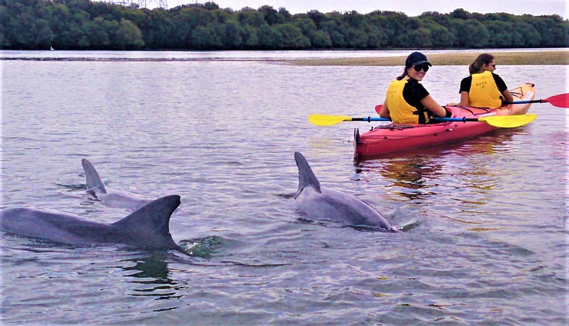
Circumnavigate Torrens Island through tidal channels, mangrove-fringed inlets, a historic ships graveyard and one of Australia’s most southerly mangrove ecosystems — with resident dolphins as your companions.
- Distance
- ~18.9 km loop
- Difficulty
- Moderate
- Trail type
- Circumnavigation
- From Adelaide
- 20 km north-west
The Torrens Island circumnavigation is one of Adelaide’s great full-day paddling adventures — a tidal journey of approximately 18.9 km through the Port River, North Arm ships graveyard, and the mangrove-lined creeks of Barker Inlet. Timing the tides correctly is essential: the route follows the falling tide clockwise and requires at least quarter tide at the northern cutting to complete the full loop.
About This Trail
Torrens Island sits within the Adelaide Dolphin Sanctuary, covering 118 square kilometres of estuarine waterways including Barker Inlet, Angas Inlet, the Port River, and the North Arm. The island is bounded by tidal channels navigable by kayak and canoe, passing mangrove forests that represent some of the most southerly mangrove communities in Australia. The area is exceptionally rich in marine life — paddlers on clear days can look down through the water to see razorfish, oysters, and eagle rays on the bottom, while swans, pelicans, ducks, ibis, cormorants, and gulls are abundant throughout. Bottlenose dolphins are regularly encountered in the Port River and North Arm.
The trail departs from the Garden Island Boat Ramp and travels clockwise past the historic ships graveyard in the North Arm, into the Port River, then north along the western side of Torrens Island before passing through the cutting at the island’s northern tip and returning south through Barker Inlet. The cutting was once maintained to allow passage of vessels carrying explosives to the magazine on the island’s northern shore — the last shipment was unloaded in 1970. The magazine, opened in 1903 and closed in 1995, is still standing to the south across the salt pans.

Paddle SA is the governing body of paddle sport and recreation in South Australia. It leads and supports paddling in South Australia and encourages the safe exploration of our waterways.
Paddling Trails South Australia has a range of trails to suit different abilities. Know your ability.
🌐 paddlesa.au →Launch Site & Route
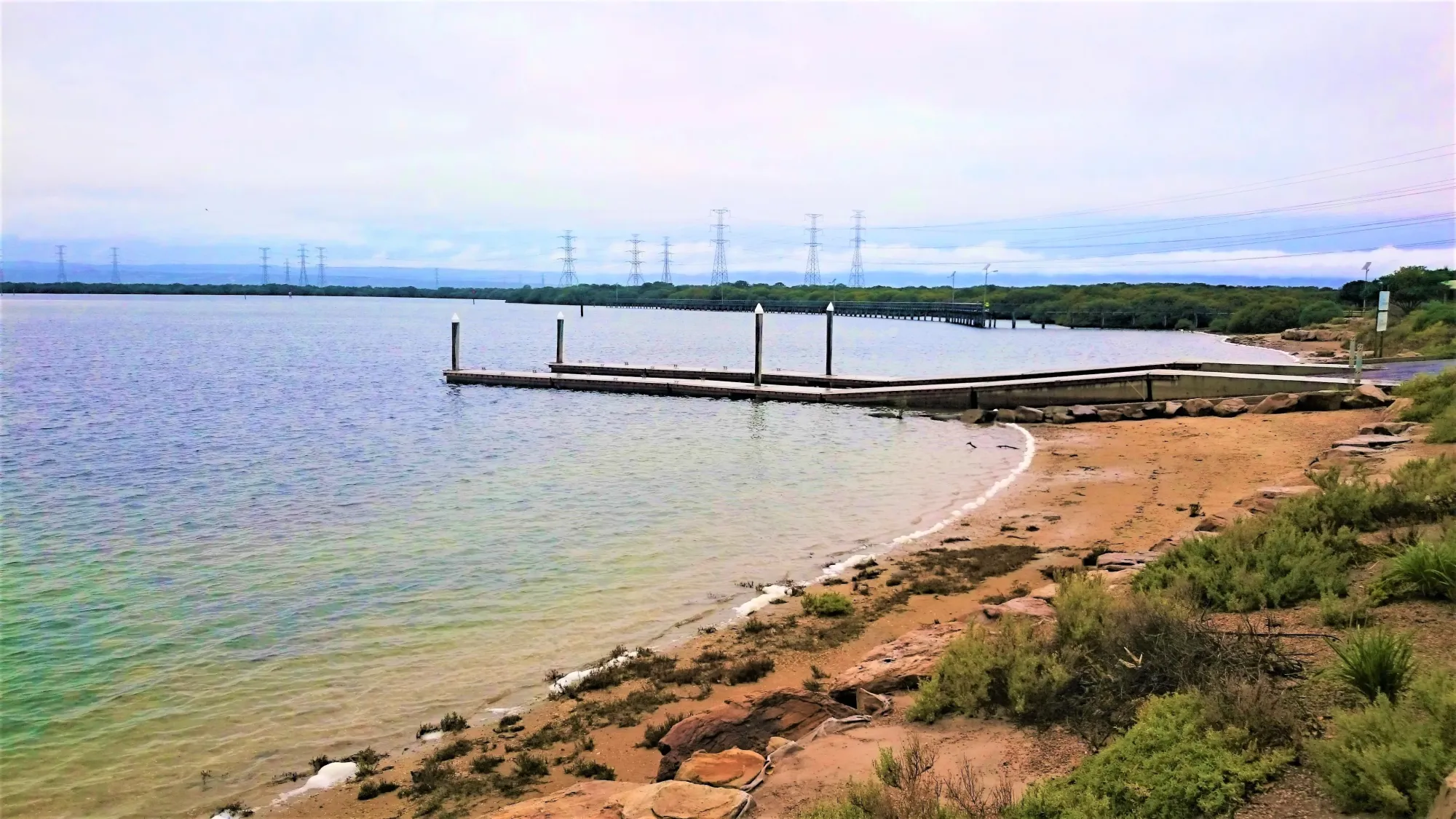
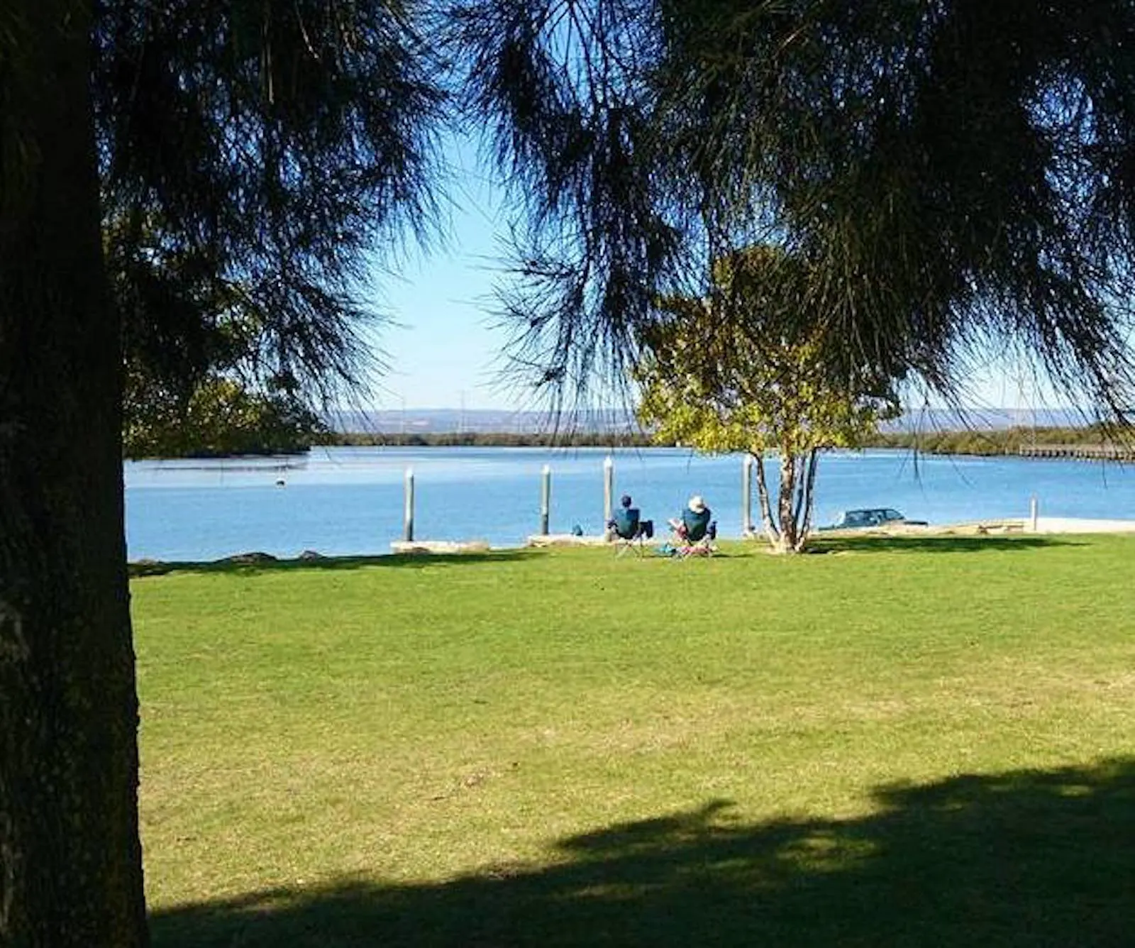
The trail begins and ends at the Garden Island Boat Ramp, reached via the Grand Trunkway across the Torrens Island Bridge — about a 25-minute drive from Adelaide’s CBD. The ramp is often busy with powered craft — always give way when in the boating channel. Facilities at Garden Island include toilets, change-rooms, BBQ shelters, picnic tables, and extensive parking. A boat wash-down area is available on site; bring your own hose with clip-lock fittings.
| Site | Location | Notes |
|---|---|---|
| Garden Island Boat Ramp | Garden Island, Port Adelaide. GPS: 34.8045 S; 138.5394 E. Take the Grand Trunkway, cross the North Arm bridge, turn right onto Garden Island and follow the road to the boat ramp car park. Powered craft frequently use this ramp — give way at all times when launching or retrieving. Boat wash-down area on site. |
Route Description
- Clockwise leg — North Arm & Port River (Garden Island → The Cutting, approx. 9.5 km): Launch from Garden Island Boat Ramp and paddle north-west along the North Arm, passing the historic ships graveyard wrecks on your right. Continue north into the Port River. At the northern tip of Torrens Island, navigate the cutting — check tidal height before committing. The cutting requires at least 1.2 m at Outer Harbour. The sole rest stop on this western side is the beach at Snapper Point, just north of Mutton Cove, near the Excelsior shipwreck.
- Return leg — Barker Inlet (The Cutting → Garden Island, approx. 9.4 km): Once through the cutting, head south through Barker Inlet. French Tom Creek (Point B, GPS: 34.7797 S; 138.5334 E) on the Barker Inlet side leads into the interior of the island and is worth a short side-exploration — it forks at its upstream end, with both branches disappearing into mangroves. Rest spots include the beach at Snapper Point and the numerous sandbanks that emerge at low tide. Do not land near the Quarantine Station or power station.
Points of Interest
- Launch Garden Island Boat Ramp (GPS: 34.8045 S; 138.5394 E) — launch and exit point. Busy ramp shared with powered craft — give way at all times in the boating channel. Facilities include toilets, change-rooms, BBQ shelters, parking, and a boat wash-down area. Interpretive signs near the ramp provide historical context on the ships graveyard before you launch.
- A The Cutting — Northern Tip of Torrens Island (GPS: 34.757 S; 138.514 E) — the narrow channel at the northern end of the island, once maintained for the passage of explosives barges to the island’s magazine. Vessels carrying explosives used the cutting to stay well clear of other shipping. Not navigable at low tide — requires at least 1.2 metres as measured at Outer Harbour. At high tide, the route can be extended north around Point Grey instead.
- B French Tom Creek (GPS: 34.7797 S; 138.5334 E) — named for a fisherman of long ago, this creek leads into the interior of Torrens Island from the Barker Inlet side. At its upstream end there is a fork — the left branch almost turns back on itself, and the right branch also turns left and disappears into mangroves. A worthwhile short diversion on the return leg.
- C North Arm Ships Graveyard — paddling north-west from Garden Island, the remains of numerous historic vessels line the mudflats: sailing ships, steamers, ferries, barges, and dredgers. The Santiago is among the oldest iron ships; the Dorothy H Sterling, Glaucus, and Sunbeam are other prominent wrecks. Best viewed at low tide. Clear water in the channel allows you to see razorfish, oysters, and eagle rays on the bottom.
- D Snapper Point Beach — on the western side of the Port River just north of Mutton Cove, near the remains of the Excelsior shipwreck. The Excelsior wreck is visible at low tide. This is the only reliable landing spot on the Port River side of the route — a good place for a break before or after the cutting. There was also a historic explosives transfer facility at Snapper Point, behind a protective mound.
- E Barker Inlet Sandbanks & Bird Island — numerous sandbanks emerge at low tide in Barker Inlet on the return leg south, providing rest spots along what is otherwise a mangrove-fringed shore. Bird Island, north of the cutting, is a sandy beach popular as a lunch stop — with views of swans, pelicans, mangroves, and distant container ships. The shallows of northern Barker Inlet are the haunt of large flocks of black swans.
- F Torrens Island Quarantine Station — the historic 1879 quarantine station is visible from the water on the eastern side of Torrens Island. Built to isolate arriving passengers and prevent diseases such as smallpox entering the colony, it served as an internment camp for German and Austrian citizens during World War I. Administered by the Commonwealth Government from 1912, modern bird quarantine facilities were added before closing in 2012 when operations moved to Melbourne. No public access — view from the water only.
Environment & Wildlife
The mangroves lining Torrens Island and Barker Inlet belong to a single species — the grey mangrove ( Avicennia marina var resinifera) — and represent one of the most southerly mangrove communities in Australia. The Torrens Island mangroves provide one of the few breeding sites in South Australia for the Little Egret and the Rufous Night Heron. On the water, paddlers can expect to see swans, pelicans, ducks, ibis, cormorants, gulls, and herons. In clear, calm conditions, the channel bottom reveals beds of razorfish, native mud oysters, and cockles, along with eagle rays gliding across the sandy substrate.
The warm water outlet from the Torrens Island Power Station on the eastern side of the island returns cooling water to the estuary at an elevated temperature, attracting bream, mullet, whiting, and Mulloway, which in turn draw herons, pelicans, terns, and egrets to the area. Seagrass beds of Posidonia and Zostera throughout Barker Inlet provide nursery habitat for juvenile western king prawns and King George whiting. Blue swimmer crabs breed on the mudflats near the river mouth.
History
Torrens Island takes its name from Robert Torrens Senior, chairman of the South Australian Colonisation Commission. Prior to European settlement, the mangrove and samphire swamp areas were a rich hunting and gathering ground for the local Kaurna people, who caught crabs, speared and netted fish, and collected shellfish from the intertidal zones.
From 1870 to the 1980s the island served as a quarantine station for both people and animals entering the state. During World War I it was repurposed as an internment camp for South Australians of German and Austrian background. The explosives magazine on the island’s northern shore operated from 1903 to 1995, with vessels using the cutting at the island’s northern tip to reach it well away from other shipping. The last explosives shipment was unloaded in 1970. Three gas-powered electricity stations now operate on the island: Torrens Island Power Station (1963), Quarantine Power Station (2002), and Barker Inlet Power Station (2009).
Tides & Weather
Tidal planning is the most important preparation for this trail. The recommended direction is clockwise, departing with the falling tide so the tidal flow assists progress through the Port River and around the northern tip. Tides in Barker Inlet run approximately 30 minutes later than at Outer Harbour; in the tidal creeks, up to an hour later. The tidal range at springs exceeds 2 metres — at low water springs, much of the area dries or becomes too shallow to paddle.
Always check the Bureau of Meteorology forecast and tide tables before departing. Westerly and south-westerly winds can generate challenging conditions, particularly in open stretches of Barker Inlet and the northern Port River. Mosquitoes can be intense close to the mangroves around dawn and dusk — bring insect repellent and cover up. Small mangrove crabs live under rocks in the intertidal zone; watch your hands when landing.
Trail Gallery
4 photos