


 Paddle SA is the governing body of paddle sport and recreation in South Australia. It leads and supports paddling in South Australia and encourages the safe exploration of our waterways.
Paddling Trail South Australia has a range of Paddling Trails to suit different abilities.
Know your ability.
Paddle SA is the governing body of paddle sport and recreation in South Australia. It leads and supports paddling in South Australia and encourages the safe exploration of our waterways.
Paddling Trail South Australia has a range of Paddling Trails to suit different abilities.
Know your ability.  https://canoeadventure.com.au/
Canoe Adventures Riverland hire and deliver kayaks in this area.
www.facebook.com/
 If you have a smartphone or tablet you can download the free Avenza PDF Map app and have interactive paddling trail maps on hand when you need them. The app uses your device’s built-in GPS to plot your real-time location within the park onto a map. The app can be used without a network connection and without roaming charges. You can also measure area and distance, plot photos, and drop Placemark pins.
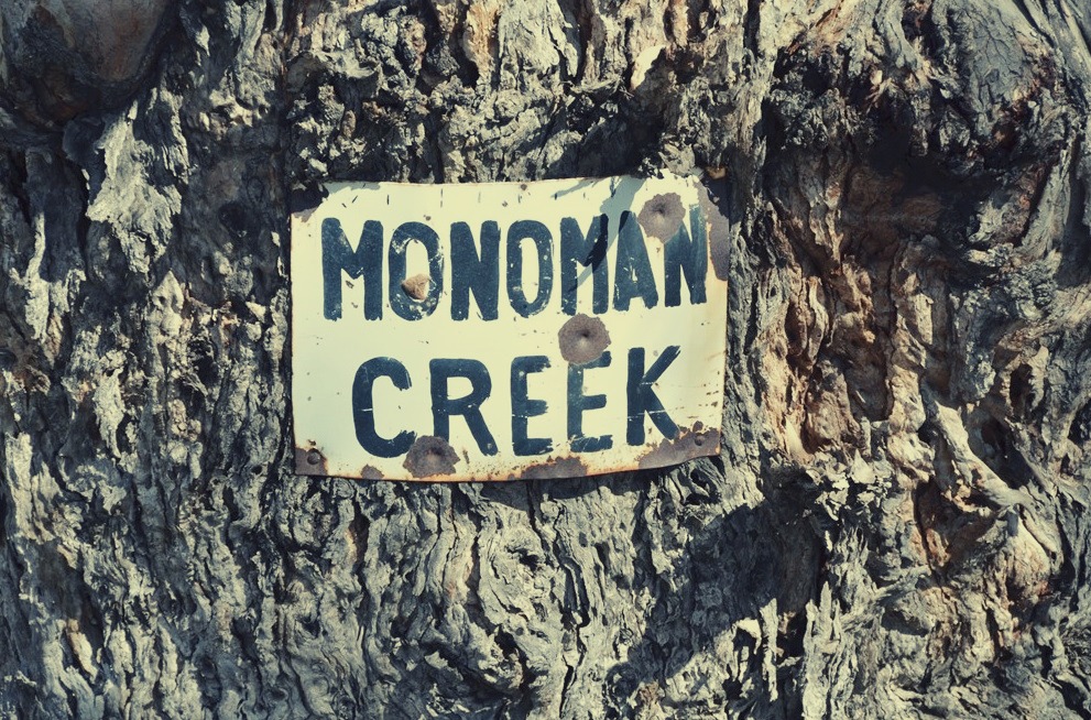
![]() Launch point is next to the locked bridge over Monoman Creek (GPS: 33.9623 S; 140.8732 E)
Launch point is next to the locked bridge over Monoman Creek (GPS: 33.9623 S; 140.8732 E)
To reach this site, turn right into the National Park entrance 48 km north of Renmark travelling on the Wentworth Road. This turn off is at GPS: 33.9520 S; 140.8497 E. The launch point is at the bridge approx 2 km along this track.
There is a locked bridge at the launch site preventing vehicles from driving onto Monoman Island. Launching of craft can be done anywhere near this bridge.
The trail can be completed in either direction. This description of the trail runs in a clockwise direction
Start at the bridge and head north for about 4km where you will reach the junction with Chowilla Creek at Point D GPS 33.9532 s 140.8987 E.
Turn right into Chowilla Creek.
Paddle about 1.8km and you will pass the entrance to Boat Creek on the LHS at Point C (GPS 33.9605 S 140.8946 E).
The next landmark is a bridge across the creek about 2km further on from Boat Creek.
Continue on your journey for a further 3km and you will reach the junction of Monoman Creek with Chowilla Creek at Point B (GPS 33.9814 S; 140.8624 E).
Turn right here into the creek. Your starting point will be about 4-5 km ahead.
Parking at launch point is next to the locked bridge over Monoman Creek (GPS: 33.9623 S; 140.8732 E)