Myponga Reservoir
Paddle a pristine drinking-water reservoir in the heart of the Fleurieu Peninsula — calm freshwater, abundant birdlife, and a purpose-built all-access launch pontoon for paddlers of all abilities.
- Distance
- 8 km return
- Difficulty
- Easy
- Trail type
- Return
- From Adelaide
- 60 km south
Myponga Reservoir is one of South Australia’s most rewarding family paddling destinations — a calm, pristine freshwater reservoir set in a picturesque valley 60 km south of Adelaide. An 8 km return paddle takes you along the northern shoreline to the dam wall and back, passing pine forests, native bush, and abundant wildlife.
About This Trail
Myponga Reservoir is managed by SA Water as part of the drinking water supply for Victor Harbor and the southern Adelaide suburbs. SA Water has invested in a purpose-built all-access canoe and kayak launch pontoon to make this trail accessible to paddlers of all ages and abilities — including children, those with a physical disability, and older paddlers who may find traditional launches challenging.
The reservoir and its surrounding reserve offer a changing landscape of native bushland, plantation pine forest on the north shore, and open grassy reserve land on the eastern side. The water is calm and sheltered on most days, making it ideal for beginners and families. Fishing is permitted with a valid SA Water permit, and the reservoir has been stocked with Murray cod (catch and release), golden perch, silver perch, rainbow trout and brown trout.
The trail is open daily 7:30am–5pm (standard time) and 7:30am–8pm (daylight saving time), except on Total Fire Ban Days, Christmas Day, and during scheduled operational activity when gates will be closed. The Eatts Street car park holds approximately 50 vehicles. Public toilets are available on Hansen Street nearby. Note that dogs are not permitted at the reserve (assistance animals excepted), as they pose a risk to water quality and local wildlife.

Paddle SA is the governing body of paddle sport and recreation in South Australia. It leads and supports paddling in South Australia and encourages the safe exploration of our waterways.
Paddling Trails South Australia has a range of trails to suit different abilities. Know your ability.
🌐 paddlesa.au →Launch Site & Route
The designated launch point is the all-access pontoon at Pink Gum Hub, approximately 180m from the Eatts Street car park. Note: As of 2026, this facility is temporarily unavailable due to upgrade works — a temporary launch has been established 1.6 km away. Check SA Water’s website before visiting. All craft must launch from designated areas only.
| Site | Location | Notes |
|---|---|---|
| Pink Gum Hub — All-Access Pontoon | Eatts Street car park, Myponga. GPS: 35.3935 S; 138.4545 E. All-access pontoon approximately 180m from car park, designed for all abilities. No wheelchair storage at the facility. In low water periods, bring a trolley. Temporarily unavailable during upgrade works — temporary launch 1.6 km from main pontoon with portable toilets. |
Route Description
- Outward leg (Point A → dam wall, approx. 4 km): Launch from the pontoon and keep left — there is a reed bed directly in front of the launch area. Head west along the northern shoreline. At approximately 2.5 km you will see open water to your left; paddle left around the headland for about 400 m to reach the dam wall on your right. A boom and warning buoys mark the exclusion zone in front of the dam — do not pass beyond these markers.
- Return leg (dam wall → Point A, approx. 4 km): Return from the dam wall. Continue paddling east towards South Road, exploring the inlets in the area. The eastern side of the reservoir is public reserve land and you may land to explore on foot. The return paddle to the launch site is an easy 4 km.
Points of Interest
- A All-Access Launch Pontoon (GPS: 35.3935 S; 138.4545 E) — the purpose-built pontoon near the Eatts Street car park. Designed to be accessible for all ages and abilities. Keep left on departure to avoid the reed bed directly ahead.
- B North Shore Pine Forest — at approximately 1–2 km along the north shore you will paddle alongside a substantial pine forest plantation. This area is largely private property and access ashore is not permitted. The forested hillside creates a dramatic backdrop from the water.
- C Headland Turn (approx. 2.5 km) — at about the 2.5 km mark, open water appears to your left. Paddle slightly left around the headland for approximately 400 m to reach the dam wall area. Warning buoys mark the exclusion zone.
- D Dam Wall (approx. 4 km) — the eastern face of the Myponga Dam. A boom and warning buoys mark the exclusion zone — do not pass beyond them. This is the turnaround point of the trail.
- E Eastern Inlets & Reserve Land — on the return leg heading east towards South Road, explore the sheltered inlets on the eastern side of the reservoir. All land on the eastern side is public reserve and paddlers may come ashore to explore on foot.
The Reservoir & Environment
Myponga Reservoir holds 27.6 gigalitres and was built between 1958 and 1962 as part of a period of rapid economic expansion in South Australia. It supplies treated drinking water to communities on the Fleurieu Peninsula via the Myponga Water Treatment Plant. The reservoir sits within a picturesque valley surrounded by native bushland and plantation pine forest (currently being harvested, with cleared areas to be returned to native vegetation).
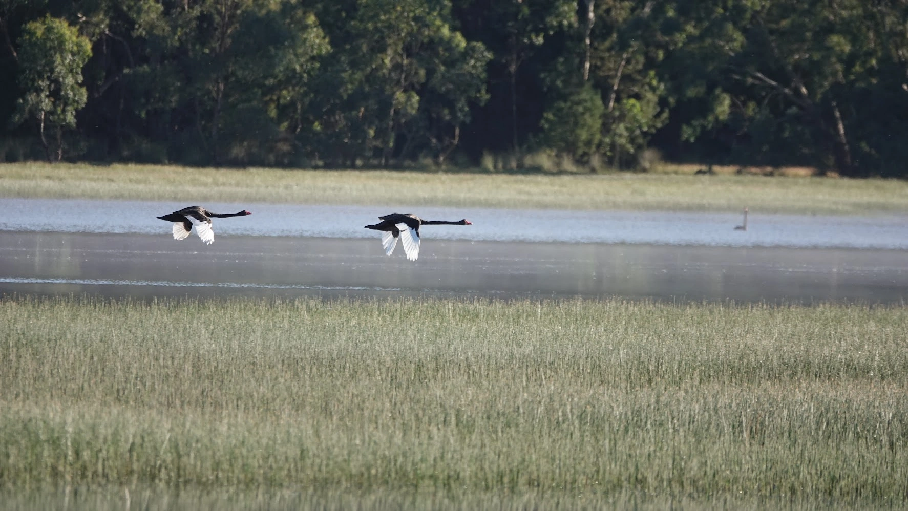
More than 120 bird species have been recorded in the reserve, from waterbirds such as cormorants, herons, ducks and grebes to an array of woodland species inland. Kangaroos are abundant throughout the reserve. Please keep your distance from all wildlife — do not feed, disturb, or remove native flora and fauna. Dogs are not permitted at the reserve (assistance animals excepted).
The reserve offers 10.5 km of unsealed trails. The 3.3 km south-eastern loop passes open plains, forested areas and native vegetation — easy and suitable for families. The 3 km western loop is a Grade 3 trail with short steep sections and uneven surfaces. A lookout above the dam wall on the western side offers a prime view of the reservoir, dam, and spillway. When water levels are low, the Heron Loop leads to a deck lookout at the water’s edge.
Fishing at Myponga Reservoir
Fishing is permitted in Myponga Reservoir with a valid SA Water permit. The reservoir has been stocked with Murray cod (catch and release only), golden perch, silver perch, rainbow trout, and brown trout. Shore-based fishing is available within the reserve’s publicly accessible area. Fishing from a canoe or kayak opens up areas not accessible to shore-based anglers.
Permits are available directly from SA Water at sawater.com.au/forms/buy-a-fishing-permit. A three-day permit costs $10 ($8 concession), a 10-day permit $20 ($16 concession), and an annual permit $33 ($26.50 concession). Catch limits apply — check the PIRSA website at www.pir.sa.gov.au for current conditions. Note that due to current construction works, some shoreline areas may be steep, slippery, or have deep sucking mud — take care when fishing from shore.
Trail Gallery
5 photos