


 Paddle SA is the governing body of paddle sport and recreation in South Australia. It leads and supports paddling in South Australia and encourages the safe exploration of our waterways.
Paddling Trail South Australia has a range of Paddling Trails to suit different abilities.
Know your ability.
Paddle SA is the governing body of paddle sport and recreation in South Australia. It leads and supports paddling in South Australia and encourages the safe exploration of our waterways.
Paddling Trail South Australia has a range of Paddling Trails to suit different abilities.
Know your ability.  If you have a smartphone or tablet you can download the free Avenza PDF Map app and have interactive paddling trail maps on hand when you need them. The app uses your device’s built-in GPS to plot your real-time location within the park onto a map. The app can be used without a network connection and without roaming charges. You can also measure area and distance, plot photos, and drop Placemark pins.
Launch Site: ![]() Good access to river at McBeans Pound (GPS 34.2871 S; 139.6317 E) – the Lazy B Landing.
Good access to river at McBeans Pound (GPS 34.2871 S; 139.6317 E) – the Lazy B Landing.
To get there take the McBeans Pound road just after the first stock grid on the Blanchetown/Morgan Rd. Turn right onto this dirt road heading toward the river. Proceed down the cliff to the Pound and turn immediate right where the bitumen ends. The launch site is approximately 200m from here.
Trail Points:
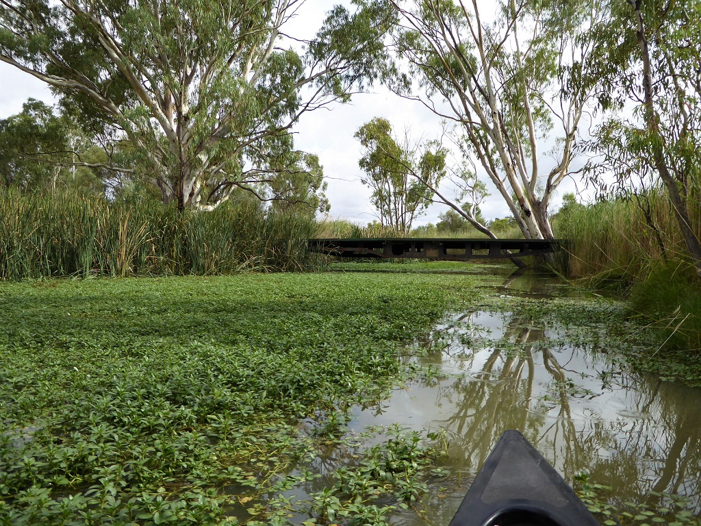
Set off upstream from the McBeans Pound (Lazy B Landing) launch site. There are no portages involved in this paddle trail and both lagoons have abundant bird life.
![]() The entrance to Sinclair Lagoon is about 2km upstream from the Lazy B Landing at Point A (GPS: 34.2753 S; 139.6379 E). There is a low bridge across the channel which is not passable if the water level is up. In this case you have no choice but to return to the river and head upstream towards Irwin Flat Lagoon.
The entrance to Sinclair Lagoon is about 2km upstream from the Lazy B Landing at Point A (GPS: 34.2753 S; 139.6379 E). There is a low bridge across the channel which is not passable if the water level is up. In this case you have no choice but to return to the river and head upstream towards Irwin Flat Lagoon.
![]() If you are able to continue under the bridge then proceed to Sinclair Flat lagoon and paddle northwards through it. There is another low bridge at the exit point, Point B (GPS: 34.2616 S; 139.6340 E) which is located at the north-eastern corner of the lagoon.
If you are able to continue under the bridge then proceed to Sinclair Flat lagoon and paddle northwards through it. There is another low bridge at the exit point, Point B (GPS: 34.2616 S; 139.6340 E) which is located at the north-eastern corner of the lagoon.
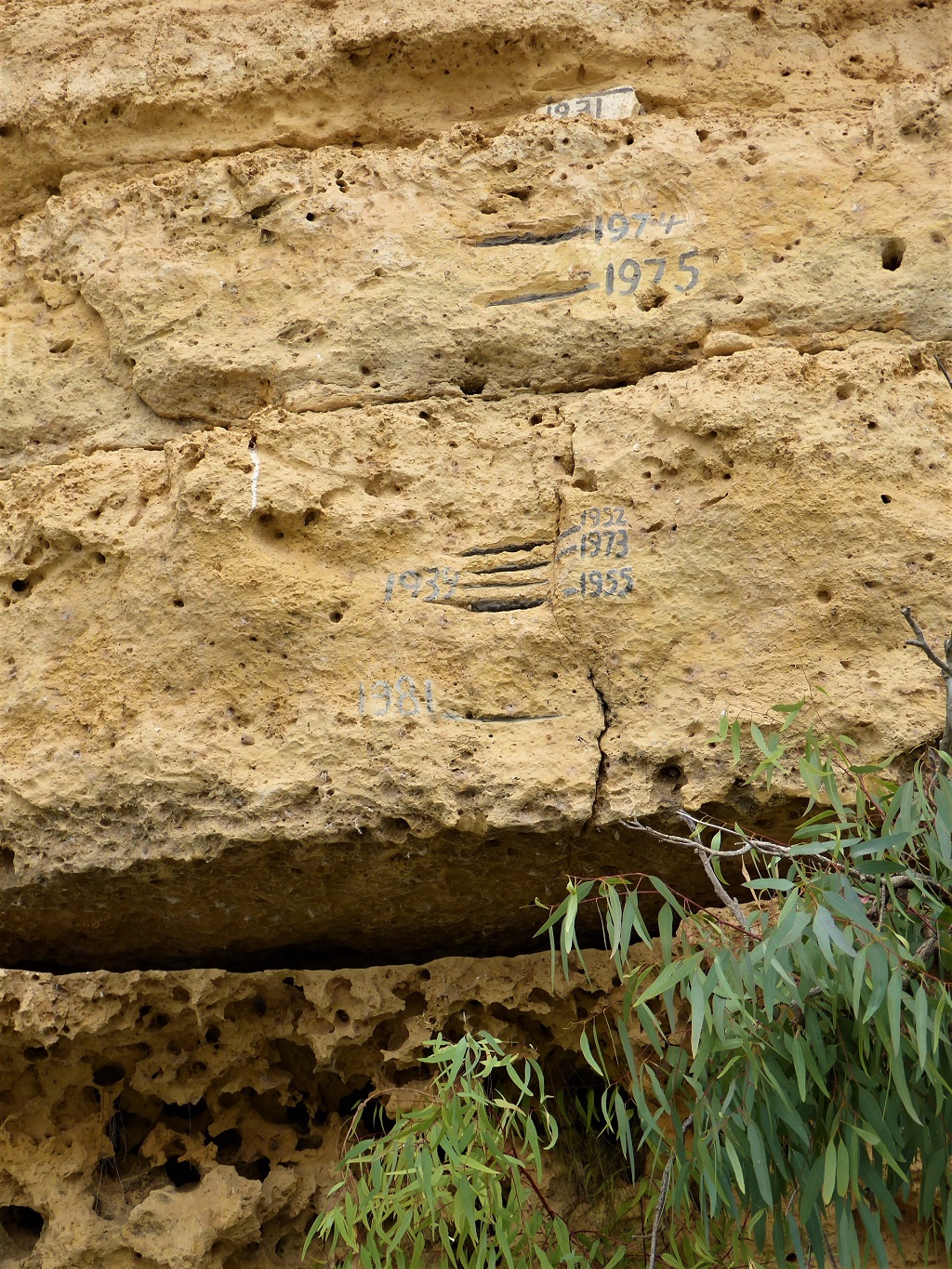
![]() Return to the river and continue upstream approximately 3 kms to Point C (GPS: 34.2342 S; 139.6439 E) which is the entrance to Irwin Flat Lagoon. At this point you will see the track heading up the cliff face to the ruin of the Woods Flat Post Office which is the last Post Office to close on the river in 1971 (see Points of Interest).
Return to the river and continue upstream approximately 3 kms to Point C (GPS: 34.2342 S; 139.6439 E) which is the entrance to Irwin Flat Lagoon. At this point you will see the track heading up the cliff face to the ruin of the Woods Flat Post Office which is the last Post Office to close on the river in 1971 (see Points of Interest).
The trail can be extended to Murbko (See Murbo Loop Trail) where camping is permitted (however note that there are no facilities here).
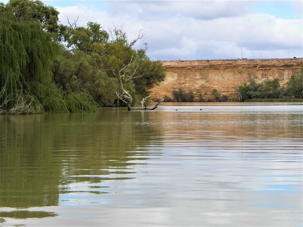
![]() The return trip takes paddlers through Donald Flat Lagoon, the entrance to which can be found at Point D (GPS: 34.2448 S; 139.6334 E). There are always large numbers of pelicans to be seen in this lagoon.
The return trip takes paddlers through Donald Flat Lagoon, the entrance to which can be found at Point D (GPS: 34.2448 S; 139.6334 E). There are always large numbers of pelicans to be seen in this lagoon.
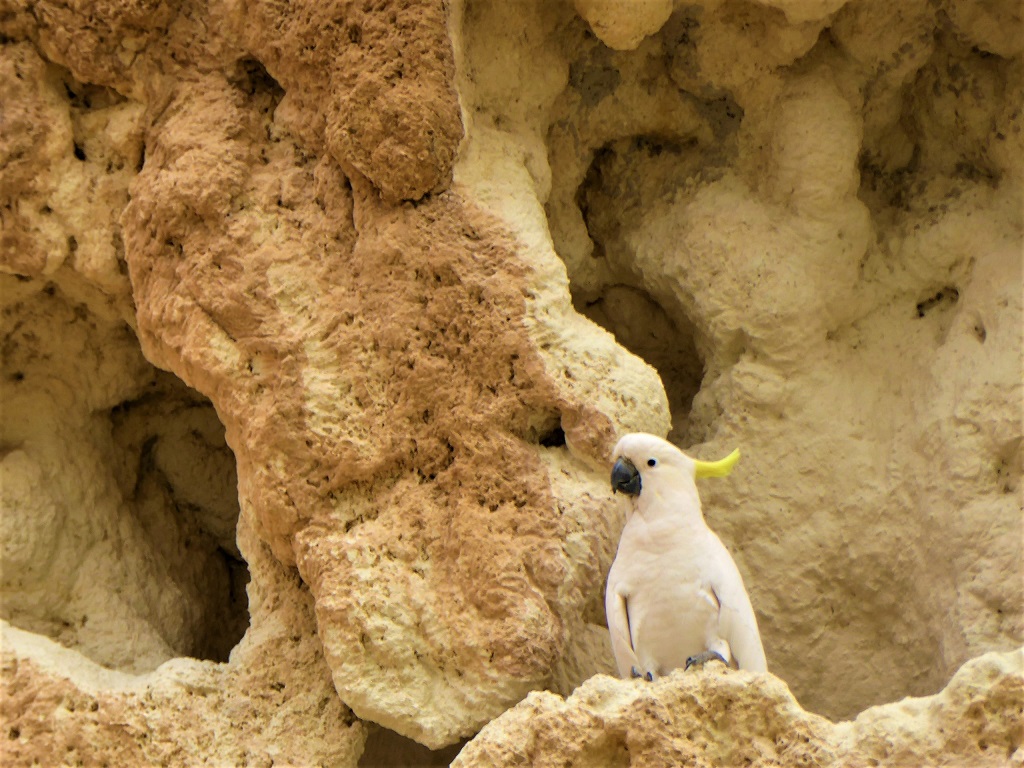
When you emerge from the southern end of Donald Flat Lagoon return to the launch point along the river. The sights and sounds of cockatoos nesting in the sandstone cliffs are a feature of this part of the trail.
![]()
![]()
![]()
Short term camping is permitted on crown land adjacent to the Murray River at the launch site however the site can only accommodate a limited number of people.
River birdlife: Pelicans, whistling kites, cockatoos and cormorants
Australian Pelican (Pelecanus conspicillatus) These majestic birds, whether soaring high overhead, coming in to land on the water like a water skier or swimming in convoys on the water are a distinct feature of any Murray River paddling trip. They are the only pelican species in Australia and are found throughout South Australia, moving inland to ephemeral inland lakes in wet years from their normal habitat near the sea and along the river and Coorong.
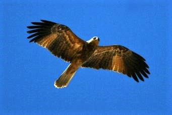 Whistling kites (Haliastur sphenurus) are found along the Murray River and its tributaries. Whistling Kites are named after their high-pitched whistle call consisting of a descending “seeeeo” followed by a fast ascending sequence of 4 – 7 staccato notes. Often one can tell there are Whistling Kites in the area from their whistle before a bird is seen. They are frequently seen circling lazily overhead, uttering their characteristic whistling, and displaying a distinctive underwing pattern with white “windows”.
Sulphur-crested Cockatoos (Cacatua galerita) are common along the River Murray. Their loud, harsh and grating call is well known and these showy white birds with their spectacular yellow erectile crest can be seen in great numbers as they move about the river environment eating a wide range of seeds, fruits and buds from native trees. Cockatoos will commonly be seen entering and leaving their nesting holes in the cliffs of the river especially during the breeding season from August to January.
Cormorants:
The Little Pied Cormorant (Microcarbo melanoleucos) is one of the most common of Australia’s waterbirds. It is entirely black above and white below. The face is dusky and, in adult birds, the white of the underside extends to above the eye. It is often seen in large flocks on open waterways and on the coast, especially where large numbers of fish are present. On inland streams and dams, however, it is often solitary.
