Grand Junction Island Loop Trail
A 2–3 day loop through the semi-arid Chowilla floodplain near Border Cliffs — a wildlife haven largely untouched by irrigation and development, with kangaroos, emus, parrots and pelicans as your companions.
- Distance
- 33.5 km approx.
- Difficulty
- Easy–Moderate
- From Adelaide
- 265 km north-east
The Grand Junction Island Loop Trail is a 33.5 km, 2–3 day circuit through the semi-arid backwaters of the Chowilla floodplain — one of Australia’s most remote and pristine river environments. Starting and finishing at the Border Cliffs Canoe Launch near the historic Customs House, the trail winds through Salt Creek and Hypurna Creek, crossing briefly into New South Wales before returning to South Australia.
About This Trail
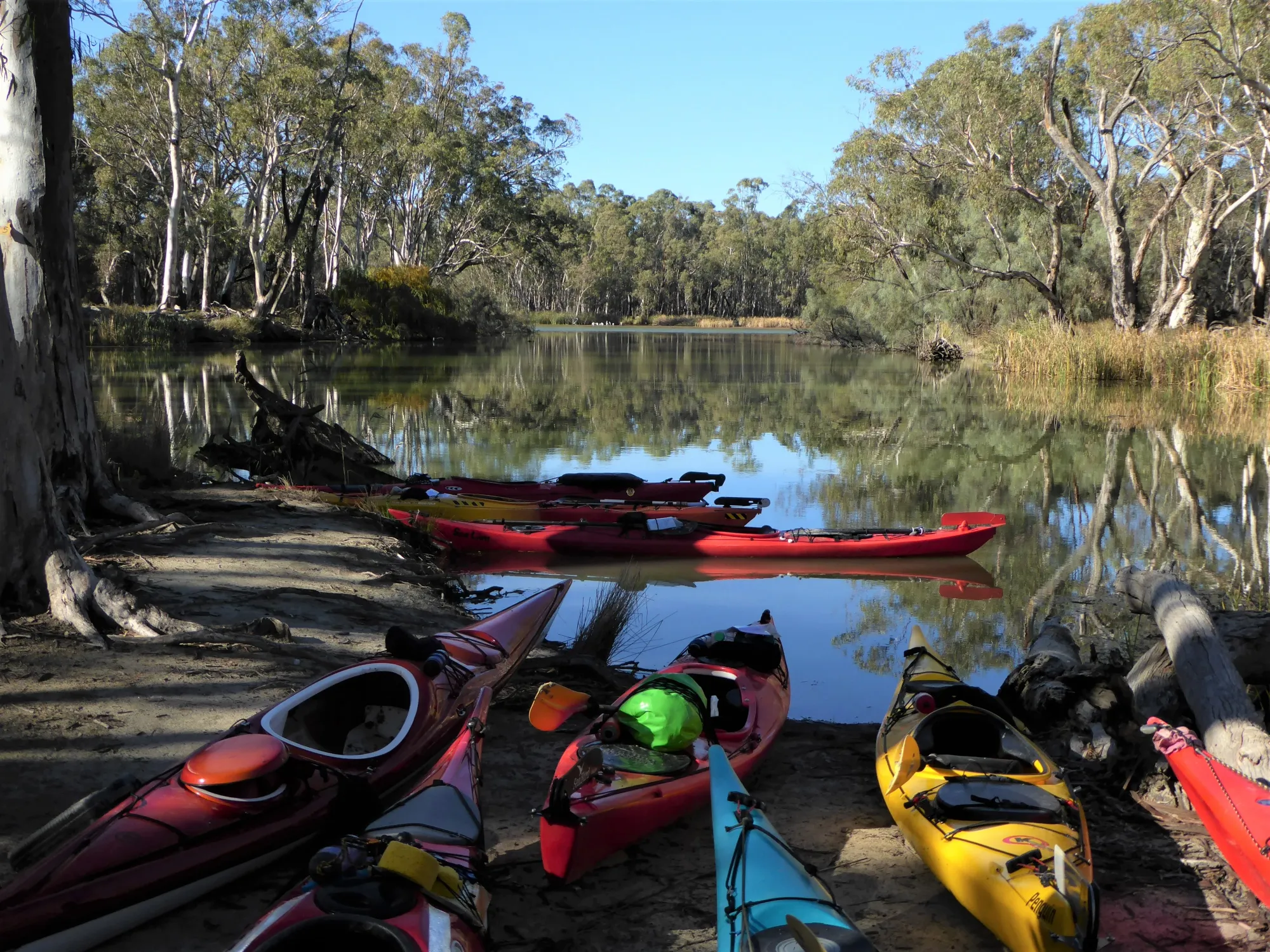
This trail takes paddlers deep into an area of the Chowilla floodplain that is largely untouched by irrigation and development — a semi-arid landscape of ancient river red gums, black box woodland, and quiet creek backwaters alive with wildlife. Kangaroos, emus, parrots, pelicans, black swans, and wedge-tailed eagles have all been reported along this route.
The trail crosses the SA–NSW border multiple times. When in NSW, paddlers are in Kulkurna (formerly Tareena Station) where camping is not permitted. All campsites used overnight must be within SA and must be pre-booked through National Parks. This is a remote location — mobile coverage is unreliable throughout and a satellite phone is strongly recommended.
A notable feature of the trail is the entry into the creek system via Suders Creek — known as “The Shute”. This fast-flowing, narrow creek sweeps paddlers directly from the Murray River into Hypurna Creek. It is not recommended for inexperienced paddlers and should be reconnoitred on foot before committing. A safe portage alternative is provided at Point W.
- Camping permits required — book at parks.sa.gov.au before leaving mobile range. Firewood must be carried in.
- No camping in NSW — Kulkurna (formerly Tareena Station) is private land. All overnight camps must be in SA.
- Satellite phone recommended — Telstra Blue Tick coverage is unreliable throughout the area.
- Park may close during high river levels — navigation becomes confused and campsites may be inundated. Check National Parks SA alerts before departing.
- Duck hunting season (generally March–June) — hunting activities may be heard in the area. Check dates at National Parks SA website.
- Access to campsites may be limited during planned environmental flows. Check National Parks SA for current alerts.

Paddle SA is the governing body of paddle sport and recreation in South Australia. It leads and supports paddling in South Australia and encourages the safe exploration of our waterways.
Paddling Trails South Australia has a range of trails to suit different abilities. Know your ability.
🌐 paddlesa.au →Launch Site & Route
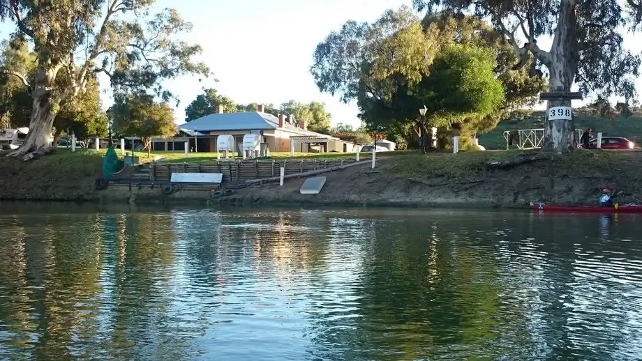
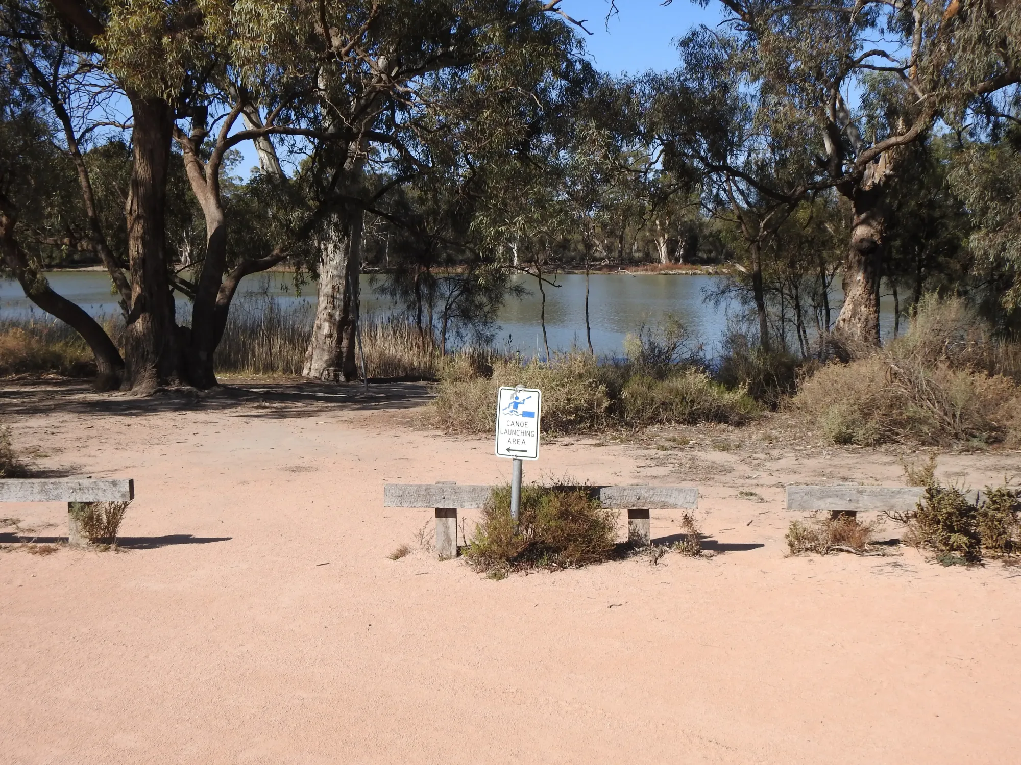
The trail starts and finishes at the Border Cliffs Canoe Launch, near the historic Border Cliffs Customs House on Murtho Road, Paringa. Shady trees, a kiosk/café, and toilets are available. The grassy picnic area, tables and BBQ belong to the Customs House — ask permission before using them. Free parking with shady trees.
| Site | Location | Notes |
|---|---|---|
| Border Cliffs Canoe Launch | Near Border Cliffs Customs House, Murtho Road, Paringa SA 5340. GPS: 33.9727°S, 140.9575°E. Free parking. Kiosk, toilets, shady trees on site. Ask permission for use of Customs House picnic area. |
Route Description
- Main route — Day 1 (via “The Shute”): From the canoe launch, paddle downstream approximately 150m to Suders Creek — “The Shute” — on the right-hand side. This fast-flowing, narrow creek will sweep you through into Hypurna Creek. Once you enter, you will be carried right through. Reconnoitre on foot beforehand and check for current obstacles such as fallen trees. At the end of The Shute, turn left into Hypurna Creek and continue approximately 200m to the junction with Salt Creek at Point H (GPS: 33.9711°S, 140.9683°E).
- Alternative entry for less experienced paddlers — Point W portage: Instead of The Shute, paddle upstream approximately 1.5 km to just before the 638 km river marker at Point W (GPS: 33.9828°S, 140.9686°E). Look for the small portage sign on a tree. Portage approximately 75m into Hypurna Creek and paddle downstream to the junction of The Shute. This alternative adds approximately 2.2 km plus the 75m portage.
- Salt Creek and NSW crossing: At Point H, turn right into Salt Creek and continue. At approximately 4 km, two branches of Punkah Creek appear on the left — do not take these. Continue on Salt Creek. At Point J (GPS: 33.9636°S, 141.0016°E), you have crossed into NSW (Kulkurna — no camping permitted). Salt Creek divides at Point L (GPS: 33.9797°S, 141.0032°E): the left branch (~1.8 km) is deeper and may have snags; the right branch (~4.2 km) passes through a horseshoe lake that can hold large flocks of black swans and pelicans in good water years, but may be dry in low-flow years. Both branches meet at Point M (GPS: 33.9803°S, 141.0164°E).
- Lower Salt Creek to Hypurna Creek: Continue along Salt Creek for a further 7.8 km. At Point S (GPS: 34.0188°S, 141.0469°E) turn right and continue approximately 3.2 km to the junction with Hypurna Creek at Point Q (GPS: 34.0215°S, 141.0250°E). Note: this section may have fallen trees to negotiate.
- Hypurna Creek return to SA: Turn right into Hypurna Creek and paddle approximately 5.6 km to Point N (GPS: 33.9943°S, 140.9950°E) — you are now back in South Australia. Take the right-hand branch and continue for approximately 4 km. After a sharp bend to the right, look for the rusted tin marker on the right-hand side identifying the portage point at Point W (GPS: 33.9828°S, 140.9686°E). Portage approximately 75m back to the Murray River. Turn right on the Murray River and return to the Border Cliffs Canoe Launch.
GPS Waypoints
- ▼ Border Cliffs Canoe Launch — Start/Finish (GPS: 33.9727°S, 140.9575°E) — Near Border Cliffs Customs House on Murtho Road. Kiosk, toilets, shady parking. The Shute (Suders Creek) entrance is approximately 150m downstream.
- W River Murray Access / Portage Point (GPS: 33.9828°S, 140.9686°E) — Located just before the 638 km river marker. Used both as the portage alternative to The Shute (entry) and as the return portage (exit). Look for a rusted tin marker on a tree on the Hypurna Creek side.
- H Junction: Salt Creek & Hypurna Creek (GPS: 33.9711°S, 140.9683°E) — Turn right here into Salt Creek to begin the main loop. Stumps of an old footbridge may be visible in the water near this junction.
- J 2nd Junction: Salt Creek & Punkah Creek (GPS: 33.9636°S, 141.0016°E) — Two branches of Punkah Creek appear on the left approximately 4 km along Salt Creek, then again 750m later. Do not take these — remain on Salt Creek. You are now in NSW (no camping permitted).
- L Salt Creek Branch Point (GPS: 33.9797°S, 141.0032°E) — Salt Creek divides. Left branch: ~1.8 km, deeper, may have snags. Right branch: ~4.2 km, shallower horseshoe lake — may be dry in low-flow years but can hold large flocks of black swans and pelicans.
- M Salt Creek Branches Rejoin (GPS: 33.9803°S, 141.0164°E) — Both branches of Salt Creek meet here. Continue south along Salt Creek.
- S Junction: Salt Creek turn to Hypurna (GPS: 34.0188°S, 141.0469°E) — Turn right here. Continue approximately 3.2 km to the junction with Hypurna Creek. This section may have fallen trees to negotiate.
- Q Junction: Salt Creek & Hypurna Creek (GPS: 34.0215°S, 141.0250°E) — Turn right into Hypurna Creek and paddle approximately 5.6 km to Point N.
- N Hypurna Creek junction — back in SA (GPS: 33.9943°S, 140.9950°E) — You are now back in South Australia. Take the right-hand branch and continue approximately 4 km to the portage point at Point W.
Border Cliffs Customs House
The historic Border Cliffs Customs House sits at the SA–Victoria border on the Murray River, beneath the distinctive sandstone cliffs of Port Murtho. It was originally established to regulate the large volume of river trade between colonies. New South Wales, claiming the river as part of its colony, built customs houses at state borders to impose duties on goods transported by river from Victoria and South Australia — causing considerable dispute between colonies.
In January 1884, the SA Governor dispatched a party to establish a customs post on the SA–Vic border. The Customs House was gazetted on 8th April 1884 and built by December 1884 at a cost of less than $1,000 in current terms. It was served by four customs officers over its 20-year operation. A nearby walking trail (1.5 hours return, 4 km) leads to the lagoon wetland and offers views of the Murray River sandstone cliffs, with birdlife including great egrets, superb fairy-wrens, and white-faced herons.
Environment & Wildlife
The Chowilla floodplain traversed by this trail is part of the Riverland Biosphere Reserve — a UNESCO-designated area protecting some of Australia’s most significant remaining river red gum and black box woodland. The semi-arid character of this section of the floodplain, largely untouched by irrigation, makes it a refuge for a remarkable diversity of wildlife. Kangaroos and emus may be encountered along the creek banks, while emus have been known to observe paddlers curiously from the water’s edge.
Birdlife along the trail is exceptional — expect pelicans, black swans, wedge-tailed eagles, great egrets, superb fairy-wrens, white-faced herons, sacred ibis, and straw-necked ibis. In good water years the horseshoe lake near Point L can hold flocks of up to 150 black swans or pelicans. The Headings Cliff Lookout on Murtho Road, a short drive from the launch, offers sweeping views over the Murray floodplain from the SA–Victorian border to Renmark.