


 Paddle SA is the governing body of paddle sport and recreation in South Australia. It leads and supports paddling in South Australia and encourages the safe exploration of our waterways.
Paddling Trail South Australia has a range of Paddling Trails to suit different abilities.
Know your ability.
Paddle SA is the governing body of paddle sport and recreation in South Australia. It leads and supports paddling in South Australia and encourages the safe exploration of our waterways.
Paddling Trail South Australia has a range of Paddling Trails to suit different abilities.
Know your ability.  https://canoethecoorong.com
Kayak hire & guided tours through the amazing natural beauty of South Australia’s Coorong National Park near Goolwa. Just one hour from Adelaide.
https://canoethecoorong.com
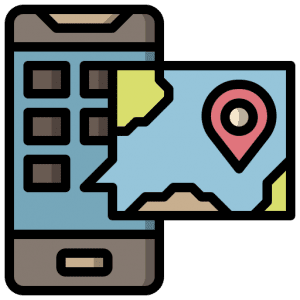
Kayak hire & guided tours through the amazing natural beauty of South Australia’s Coorong National Park near Goolwa. Just one hour from Adelaide.  If you have a smartphone or tablet you can download the free Avenza PDF Map app and have interactive paddling trail maps on hand when you need them. The app uses your device’s built-in GPS to plot your real-time location within the park onto a map. The app can be used without a network connection and without roaming charges. You can also measure area and distance, plot photos, and drop Placemark pins.
Launch Site: ![]() Wallys Landing, Tonkin road, Finniss GPS: 35.4076 S; 138.8312 E
Wallys Landing, Tonkin road, Finniss GPS: 35.4076 S; 138.8312 E
Trail Points:![]() The trail starts at Wallys Landing Reserve at the end of Tonkin road and heads down stream to the junction with the lower Murray River opposite Hindmarsh Island.
The trail starts at Wallys Landing Reserve at the end of Tonkin road and heads down stream to the junction with the lower Murray River opposite Hindmarsh Island.
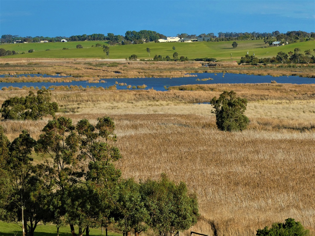
There is no point in going up stream very far from Wallys Landing as it rapidly becomes choked with reeds.
Immediately after leaving Wallys Landing take the branch to the right (The left branch is short and ends at a bridge). About half a kilometre downstream an opening will be seen on the eastern side of the stream into a lake (Point A: GPS: 35.4103 S; 138.8358 E). There is usually plenty of bird life to be found here. The lake can be followed downstream to where it re-enters the Finniss River.
From here conditions can be weedy and algal blooms may be encountered, so keep to the middle of the waterway where it is clear. The cause of the algal blooms and the weed can at least in part be attributed to the extensive farming in this area, with large areas of bordering land under irrigation for grape and wine production.
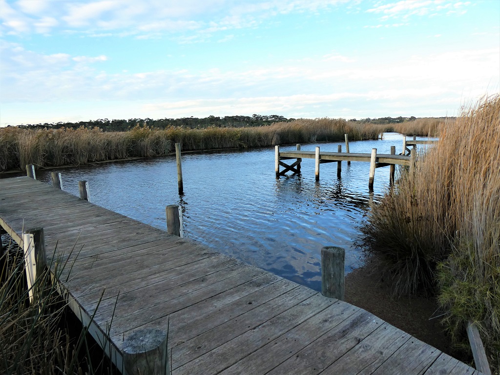
![]() Once you reach Point B GPS: 35.4343 S; 138.8500 E (The junction with Tookayerta Creek) the water will generally be clearer of weeds and the river widens out.
Once you reach Point B GPS: 35.4343 S; 138.8500 E (The junction with Tookayerta Creek) the water will generally be clearer of weeds and the river widens out.
Check weather conditions before entering this more open area as the conditions – particularly the wind – may prove difficult for novices.
It is suggested that novices turn here and return to Wallys Landing via the main stream.
If the weather is fine you can paddle a further 5 km to the junction with the Murray River at “The Hedge”.
![]()
Parking available at launch site
