


 Paddle SA is the governing body of paddle sport and recreation in South Australia. It leads and supports paddling in South Australia and encourages the safe exploration of our waterways.
Paddling Trail South Australia has a range of Paddling Trails to suit different abilities.
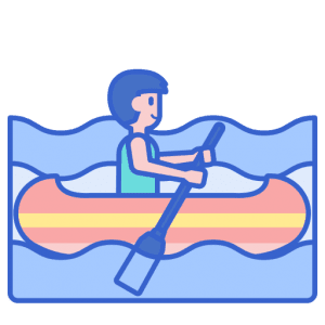
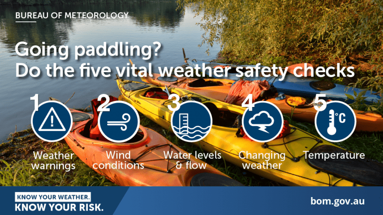
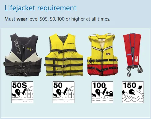
Know your ability.
Paddle SA is the governing body of paddle sport and recreation in South Australia. It leads and supports paddling in South Australia and encourages the safe exploration of our waterways.
Paddling Trail South Australia has a range of Paddling Trails to suit different abilities.
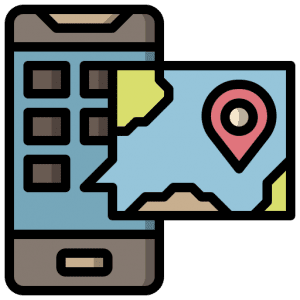
Know your ability.  If you have a smartphone or tablet you can download the free Avenza PDF Map app and have interactive paddling trail maps on hand when you need them. The app uses your device’s built-in GPS to plot your real-time location within the park onto a map. The app can be used without a network connection and without roaming charges. You can also measure area and distance, plot photos, and drop Placemark pins.
The trail starts at Kent Reserve at the mouth of the river and winds through picturesque nature reserves on the outskirts of Victor Harbor and ends at a small weir at the end of Canterbury road.
The trail can be continued above the weir to the golf course but the portage around the weir is difficult.
![]()
![]()
![]()
![]()
![]()
![]()
![]()
Toilets and picnic area at the reserve (launch site)
Full facilities in Victor Harbor
