Swan Reach (178km from Adelaide)

Paddle Time 6 hours (allow a full day)

Easy
Approx. 14 km. 6 hours (allow a full day)
Always check weather and wind conditions before setting out.
Visit BOM for weather conditions
Easy - River and river backwaters
Do the five weather safety checks
None provided at Tenbury Hunter Reserve
Limited near boat ramp
 Paddle SA is the governing body of paddle sport and recreation in South Australia. It leads and supports paddling in South Australia and encourages the safe exploration of our waterways.
Paddling Trail South Australia has a range of Paddling Trails to suit different abilities.
Know your ability.
 Trail 07
 If you have a smartphone or tablet you can download the free Avenza PDF Map app and have interactive paddling trail maps on hand when you need them. The app uses your device’s built-in GPS to plot your real-time location within the park onto a map. The app can be used without a network connection and without roaming charges. You can also measure area and distance, plot photos, and drop Placemark pins.
Launch Sites:
Two options for launch site
Tenbury Hunter Reserve campground (beside the Swan Reach Ferry) (GPS: 34.5617 S; 139.6011 E)
Swan Reach Caravan Park Public Boat Ramp (GPS: 34.5668 S; 139.5955E)
Return to the launch site to exit
If launching from the Swan Reach Caravan Park Public Boat ramp (on the eastern side of the river) then take care to avoid the Swan Reach Car Ferry as you paddle north.
Trail Points:![]() The trail starts at Swan Reach, with launch points on either side of the Murray River.
The trail starts at Swan Reach, with launch points on either side of the Murray River.
The entrance to Yacto creek from Swan Reach is about 3.3 km north of the town ferry (Point A GPS: 34.5404 S; 139.6049 E)
Until recently a portage was required but the addition of a bridge and regulator now means this is not required.
The creek has numerous fallen trees and logs which can make navigation difficult, but possible without resorting to a portage.
![]() The Pumping Station Reserve would provide an adequate location to stop for a break for those travelling to and from Swan Reach (Point B) Pumping station Reserve campground. GPS: 34.5051 S; 139.5699 E
The Pumping Station Reserve would provide an adequate location to stop for a break for those travelling to and from Swan Reach (Point B) Pumping station Reserve campground. GPS: 34.5051 S; 139.5699 E
![]() The trail is completed by returning to the launch site, either back down the creek, or along the Murray River main channel.
The trail is completed by returning to the launch site, either back down the creek, or along the Murray River main channel.
An optional, more adventurous route is possible by leaving the Murray River at the regulator at (Point C) GPS: 34.5541 S, 139.6113 E. This involves 2 easy portages and allows for a circular route as it joins Yacto Creek about halfway along.
NB Yacto Creek can be shallow, so do not attempt this route if the water level is below 0.6 m as reported by Waterconnect for Swan Reach.
![]()
![]()
![]()
![]()
Unsecured parking is available at Tenbury campground however the Swan Reach Campground should have secure parking.
Bring your own firewood.
Full facilities available at the Swan Reach Caravan Park.

Swan Reach history
Prior to European settlement, it is estimated that there were 1,200 Ngalawang tribal members in the Swan Reach area.
Swan Reach gained its name from the large number of black swans that once thrived in the area.
The natural break in the cliffs made for an ideal crossing for travelers and stock, prior to the arrival of the Ferry. Before the lock and weir system was installed it was possible, during the drought years, to walk from one side of the river to the other.
The land surrounding Swan Reach was once open plains of native speargrass and Mallee trees, of which large areas were cleared for crops were established in the area, such as stone fruits, oranges, grapes, onions, potatoes, pumpkins, garlic, almonds, and Geraldton Wax flowers (for the cut flower trade).
In the early 1850s, Thomas Luscombe was leasing 182 square miles (293 kilometers) along the Murray River, which was known as the Swan Reach Run where 23,000 sheep grazed.
The land was eventually broken up into smaller holdings and in 1896, Paul Hasse purchased 520 acres including the Swan Reach homestead.
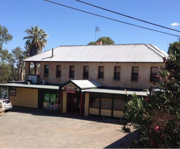
Then in 1899 a survey was conducted, dividing a portion of his land into 46 town allotments which were approved in 1900, with the homestead later becoming the Swan Reach Hotel.
(borrowed from http://www.murrayriver.com.au/swan-reach/swan-reach-history/)
Paddling Trail South Australia has a range of Paddling Trails to suit different abilities.
Know your ability
These are easy to access kayak and canoe trails through the Adelaide, Fleurieu Peninsula, Riverland, Murray River, and the Coorong.